How clean is your river? New Data Portal keeps you informed.
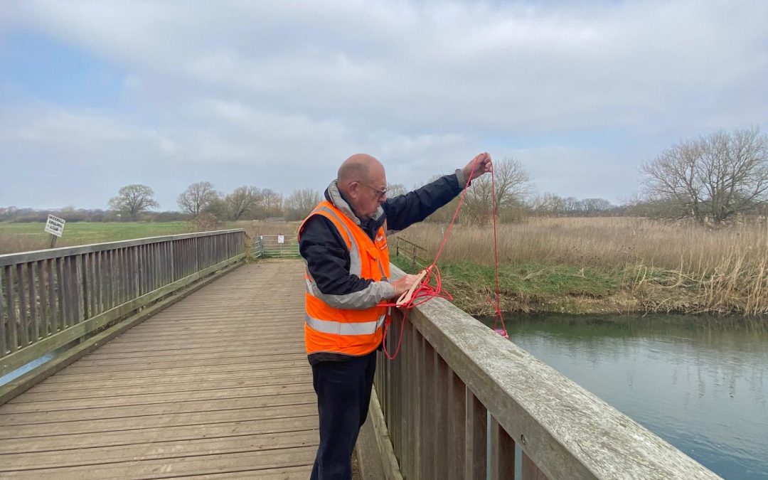
We have created a new, easy-to-use BedsGOVET Data Portal, which can be found on our website to help you find out how safe it is to use the river. We test the river every month to ascertain the water quality at 18 places along the River Great Ouse, including hotspots such as Great Barford and Felmersham, where many people use the river for bathing. Our new portal will help you decide whether you want to take the plunge – or not.
“We are so pleased to provide real-time data that allows the users of the river to check the safety levels before using the river. Our aim is to ensure that people can understand the risks associated with using the river if there has been discharge. We don’t want to stop people from enjoying the river, but we hope that they can enjoy it more safely.” Says, Alan Horn, Chair of BedsGOVET.
The Portal, is a unique information centre and was created and developed by one of our volunteers. It brings together several important data sources including, the detailed monthly water quality analyses carried out by BedsGOVET’s trained volunteer teams, the Environment Agency’s monthly sampling results, and near real time alerts of discharges from monitored water treatment plants along the river system. By combining these datasets, the Portal enables anyone to understand the pollution risks present in each stretch of the river throughout the Bedford area.
At the heart of the site is a clear, easy to read water quality dashboard on the home page, offering a quick snapshot of current conditions. Of particular interest are the discharge notifications reported by Anglian Water, along with levels of key pollutants such as potassium, ammonia, and nitrates. You can also explore more detailed, colour coded data showing the severity of pollution at each site. Most importantly for personal health assessments, the Portal displays measurements of E. coli and other harmful microbes across different sections of the river.
For those wanting a longer term view, the Portal also provides charts and graphics showing how water quality has changed over the past 12 months, helping to spot trends and understand the pressures affecting the river.
Finally, the Portal includes a comprehensive interactive map of the BedsGOVET catchment. This shows the locations of all BedsGOVET and Environment Agency sampling sites, as well as both monitored and unmonitored Anglian Water treatment facilities—giving a complete picture of the infrastructure influencing the health of the Great Ouse.
We would really like to hear your thoughts on this new development. We do hope that you find it easy to use and a helpful information centre to help keep you safe when using the river.